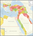
Fayl:Ottoman Empire Administrative Divisions.png
Qiyofa

Bu prevyuning hajmi: 552 × 600 piksel. Boshqa oʻlchamlari: 221 × 240 piksel | 442 × 480 piksel | 707 × 768 piksel | 943 × 1 024 piksel | 1 885 × 2 048 piksel | 4 455 × 4 840 piksel.
Asl fayl (4 455 × 4 840 piksel, fayl hajmi: 2,1 MB, MIME tipi: image/png)
Fayl tarixi
Faylning biror paytdagi holatini koʻrish uchun tegishli sana/vaqtga bosingiz.
| Sana/Vaqt | Miniatura | Oʻlchamlari | Foydalanuvchi | Izoh | |
|---|---|---|---|---|---|
| joriy | 07:16, 2021-yil 16-noyabr |  | 4 455 × 4 840 (2,1 MB) | BasilLeaf | updates |
| 19:22, 2021-yil 5-may |  | 4 455 × 4 840 (2,11 MB) | Super Dromaeosaurus | Romanian Black Sea Snake Island, Romanian-Russian border at Dobruja-Bessarabia, removed lands in Banat that didn't belong to Romania then | |
| 18:17, 2021-yil 14-aprel |  | 4 455 × 4 840 (2,03 MB) | محمد٢ | Reverted to version as of 18:40, 19 January 2021 (UTC) | |
| 02:05, 2021-yil 8-fevral |  | 4 455 × 4 840 (2,1 MB) | BasilLeaf | Minor name fixes. Iran's official English name was "Sublime State of Persia". "Arab Gulf" Doesn't exist. There's "Arabian Gulf", a name that only came to decently widespread usage from 1960s. Contemporary internationally accepted term is "Persian Gulf". | |
| 18:40, 2021-yil 19-yanvar |  | 4 455 × 4 840 (2,03 MB) | Userd898 | minor edit regarding the recoloring of a wrongly colored spot in haasa | |
| 18:05, 2021-yil 19-yanvar |  | 4 455 × 4 840 (2,03 MB) | Userd898 | fixed some mistakes in yemen and labeled qatar as occupied source: https://www.euratlas.net/history/hisatlas/arabia/1904__AR.html | |
| 18:48, 2021-yil 14-yanvar |  | 4 455 × 4 840 (2,1 MB) | BasilLeaf | Minor name fixes. Iran's official English name was "Sublime State of Persia". "Arab Gulf" Doesn't exist. There's "Arabian Gulf", a name that only came to decently widespread usage in 1960s. | |
| 19:15, 2020-yil 27-dekabr |  | 4 455 × 4 840 (2,03 MB) | Userd898 | Uploaded own work with UploadWizard |
Fayllarga ishoratlar
Bu faylga quyidagi sahifa bogʻlangan:
Faylning global foydalanilishi
Ushbu fayl quyidagi vikilarda ishlatilyapti:
- bg.wikipedia.org loyihasida foydalanilishi
- bn.wikipedia.org loyihasida foydalanilishi
- ca.wikipedia.org loyihasida foydalanilishi
- ckb.wikipedia.org loyihasida foydalanilishi
- cs.wikipedia.org loyihasida foydalanilishi
- de.wikipedia.org loyihasida foydalanilishi
- el.wikipedia.org loyihasida foydalanilishi
- en.wikipedia.org loyihasida foydalanilishi
- Ottoman Empire
- Sanjak
- Administrative divisions of the Ottoman Empire
- Kosovo vilayet
- Baghdad vilayet
- Mosul vilayet
- Scutari vilayet
- Basra vilayet
- Ottoman Tripolitania
- Ottoman Syria
- Abdul Hamid II
- Ottoman Iraq
- Mount Lebanon Mutasarrifate
- Janina vilayet
- Beirut vilayet
- Syria vilayet
- Hejaz vilayet
- Talk:Greater Palestine
- User:Falcaorib/Contemporary Empires (1800-2024 AD)
- User:Falcaorib/Turkey and Ottoman Empire
- es.wikipedia.org loyihasida foydalanilishi
- fa.wikipedia.org loyihasida foydalanilishi
- fi.wikipedia.org loyihasida foydalanilishi
- fr.wikipedia.org loyihasida foydalanilishi
- gl.wikipedia.org loyihasida foydalanilishi
- he.wikipedia.org loyihasida foydalanilishi
Ushbu faylni koʻproq global foydalanishdan koʻring.


