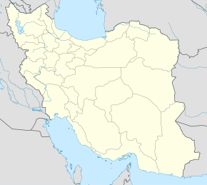
Ramjerd
Qiyofa
Ramjerd forscha: رامجرد | |
|---|---|
| Shahar | |
| 30°04′29″N 52°35′29″E / 30.07472°N 52.59139°E | |
| Mamlakat | Eron |
| Uston | Fors |
| Shahriston | Marvdasht |
| Baxsh | Dorudzon |
| Aholisi (2016) |
2 550 |
| Vaqt mintaqasi | UTC+3:30 |
|
| |
Ramjerd (forscha: رامجرد)[lower-alpha 1] Eronning Fors ustoni Marvdasht shahristoni Dorudzon baxshi shahar va uning maʼmuriy markazi[3]. Shuningdek, Ramjerdi Do dehistonining maʼmuriy markazi boʻlib xizmat qiladi[4].
Aholisi
[tahrir | manbasini tahrirlash]2006-yilgi aholini roʻyxatga olishda aholi soni 446 ta xonadonda 2033 kishini tashkil qilishi aniqlangan[5]. Keyingi aholini roʻyxatga olish 2011-yilda boʻlib oʻtgan va unda 566 ta xonadonda 2260 kishi istiqomat qilgan[6], bu vaqtga kelib qishloq shahar maqomiga koʻtarildi va Ramjerd deya atala boshladi[1]. 2016-yilgi aholini roʻyxatga olish maʼlumotlariga koʻra, shahar aholisi 713 xonadonda yashovchi 2550 kishidan iborat[7].
Yana qarang
[tahrir | manbasini tahrirlash]Qaydlar
[tahrir | manbasini tahrirlash]- ↑ Sobiq Kushkak (كوشكك)[1], shuningdek romanizatsiyasi Kūshkak[2]
Manbalar
[tahrir | manbasini tahrirlash]- ↑ 1,0 1,1 Davodi, Parviz (c. 2019) (fa). Approval letter regarding the conversion of Kushkak village, the center of Dorudzan District, from the functions of Marvdasht County in Fars province, to a city (Report). Ministry of the Interior, Political and Defense Commission. Proposal 121769/42/4/1; Notification 32137/T34440K. https://rc.majlis.ir/fa/law/show/135286. Qaraldi: 8 October 2024.
- ↑ Ramjerd can be found at GEOnet Nom Serveri, at this link, by opening the Advanced Search box, entering "-3072600" in the "Unique Feature Id" form, and clicking on "Search Database".
- ↑ Habibi, Hassan (c. 2023) (fa). Creation and establishment of rural districts and districts in Fars province (Report). Ministry of the Interior, Council of Ministers. Proposal 17549.1.4.42; Notification 10908/T47K. https://lamtakam.com/law/council_of_ministers/113634. Qaraldi: 9 December 2023.
- ↑ Mousavi, Mirhossein (12 March 2014) (fa). Creation and formation of 17 rural districts including villages, farms and places in a part of Marvdasht County under Fars province (Report). Ministry of the Interior, Council of Ministers. Proposal 53.1.11954; Notification 77352/T618. https://rc.majlis.ir/fa/law/show/110215. Qaraldi: 7 December 2023.
- ↑ (fa) (Excel) Census of the Islamic Republic of Iran, 1385 (2006): Fars Province (Report). The Statistical Center of Iran. http://www.amar.org.ir/DesktopModules/FTPManager/upload/upload2360/newjkh/newjkh/07.xls. Qaraldi: 25 September 2022.
- ↑ (fa) (Excel) Census of the Islamic Republic of Iran, 1390 (2011): Fars Province (Report). The Statistical Center of Iran. https://irandataportal.syr.edu/wp-content/uploads/Fars.xls. Qaraldi: 19 December 2022.
- ↑ (fa) (Excel) Census of the Islamic Republic of Iran, 1395 (2016): Fars Province (Report). The Statistical Center of Iran. https://www.amar.org.ir/Portals/0/census/1395/results/abadi/CN95_HouseholdPopulationVillage_07.xlsx. Qaraldi: 19 December 2022.

