
Fayl:Corte Madera California aerial view.jpg

Bu prevyuning hajmi: 800 × 534 piksel. Boshqa oʻlchamlari: 320 × 214 piksel | 640 × 427 piksel | 1 024 × 683 piksel | 1 500 × 1 001 piksel.
Asl fayl (1 500 × 1 001 piksel, fayl hajmi: 807 KB, MIME tipi: image/jpeg)
| Taʼrif |
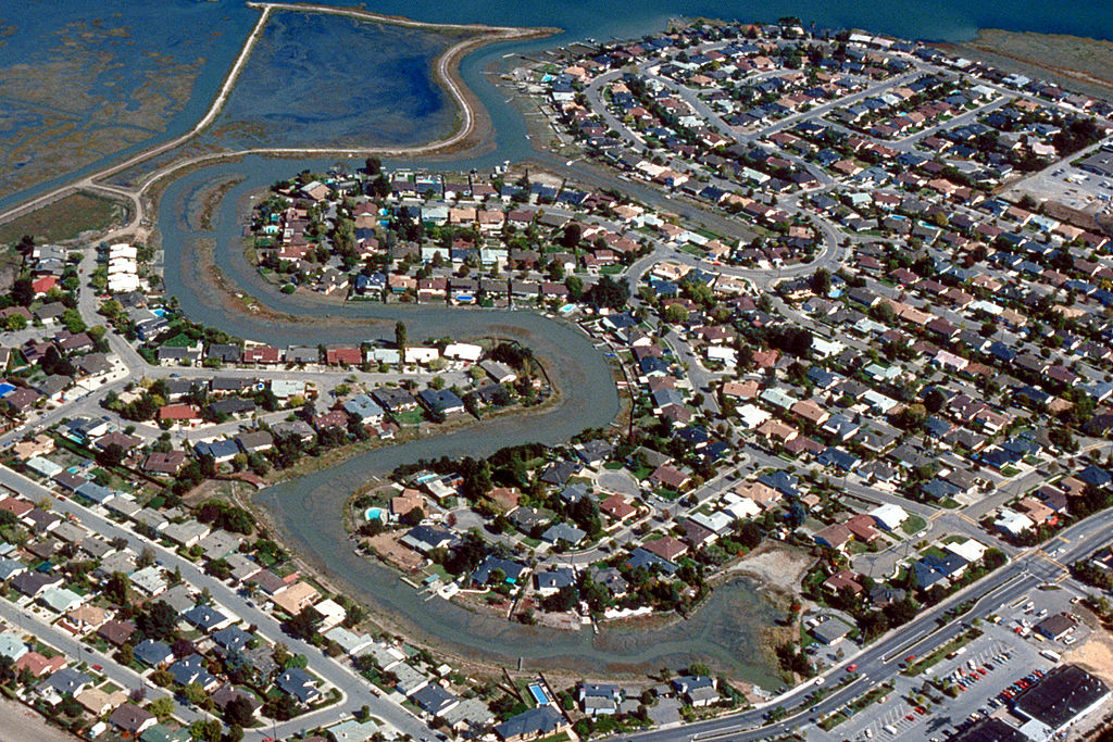
English: Aerial view of the Meadowsweet area of Corte Madera, California, USA. The city lies on the western side of upper San Francisco Bay. San Clemente Creek winds through the neighborhood. Paradise Drive is visible at the bottom of the picture. View is to the northeast.
Coordinates: 37°55′20.21″N 122°30′14.16″W / 37.9222806°N 122.5039333°W |
|||
| Location | Corte Madera, California, USA | |||
| Sanasi | not specified or unknown | |||
| Manba |
U.S. Army Corps of Engineers Digital Visual Library Image page Image description page Digital Visual Library home page |
|||
| Muallif | Robert Campbell, U.S. Army Corps of Engineers | |||
| Ruxsat (Bu faylning takror foydalanilishi) |
|
Fayl tarixi
Faylning biror paytdagi holatini koʻrish uchun tegishli sana/vaqtga bosingiz.
| Sana/Vaqt | Miniatura | Oʻlchamlari | Foydalanuvchi | Izoh | |
|---|---|---|---|---|---|
| joriy | 01:57, 3-May 2007 | | 1 500 × 1 001 (807 KB) | DanMS | {{Information | Description = {{en|Aerial view of the Meadowsweet area of Corte Madera, California, USA. The city lies on the western side of upper San Francisco Bay. San Clemente Creek winds through the neighborhood. Paradise Drive is visible at the b |
Fayllarga ishoratlar
Bu faylga quyidagi sahifa bogʻlangan:
Faylning global foydalanilishi
Ushbu fayl quyidagi vikilarda ishlatilyapti:
- ar.wikipedia.org loyihasida foydalanilishi
- bg.wikipedia.org loyihasida foydalanilishi
- cs.wikipedia.org loyihasida foydalanilishi
- en.wikipedia.org loyihasida foydalanilishi
- es.wikipedia.org loyihasida foydalanilishi
- fa.wikipedia.org loyihasida foydalanilishi
- it.wikipedia.org loyihasida foydalanilishi
- pl.wikipedia.org loyihasida foydalanilishi
- pt.wikipedia.org loyihasida foydalanilishi
- sh.wikipedia.org loyihasida foydalanilishi
- sr.wikipedia.org loyihasida foydalanilishi