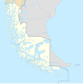
Fayl:Magallanes y Antártica Chilena location map (South American part).svg
Qiyofa

Size of this PNG preview of this SVG file: 594 × 600 piksel. Boshqa oʻlchamlari: 238 × 240 piksel | 475 × 480 piksel | 761 × 768 piksel | 1 014 × 1 024 piksel | 2 028 × 2 048 piksel | 1 535 × 1 550 piksel.
Asl fayl (SVG fayl, asl oʻlchamlari 1 535 × 1 550 piksel, fayl hajmi: 831 KB)
Fayl tarixi
Faylning biror paytdagi holatini koʻrish uchun tegishli sana/vaqtga bosingiz.
| Sana/Vaqt | Miniatura | Oʻlchamlari | Foydalanuvchi | Izoh | |
|---|---|---|---|---|---|
| joriy | 16:25, 2024-yil 5-mart |  | 1 535 × 1 550 (831 KB) | Janitoalevic | Better Beagle Channel |
| 01:21, 2022-yil 29-dekabr |  | 1 535 × 1 550 (596 KB) | Janitoalevic | . | |
| 01:21, 2022-yil 29-dekabr |  | 1 535 × 1 550 (595 KB) | Janitoalevic | Fixed region border | |
| 01:10, 2022-yil 29-dekabr |  | 1 535 × 1 550 (594 KB) | Janitoalevic | Better Southern Patagonian Ice Field | |
| 16:42, 2020-yil 20-may |  | 1 535 × 1 550 (573 KB) | Janitoalevic | Added provinces | |
| 19:43, 2020-yil 3-may |  | 1 535 × 1 550 (566 KB) | Janitoalevic | Improved Isla de los Estados | |
| 18:43, 2020-yil 3-may |  | 1 535 × 1 550 (558 KB) | Janitoalevic | Fixed lakes in the north | |
| 02:02, 2020-yil 3-may |  | 1 535 × 1 550 (556 KB) | Janitoalevic | Uploaded own work with UploadWizard |
Fayllarga ishoratlar
Bu faylga quyidagi 2 sahifalar bogʻlangan:
Faylning global foydalanilishi
Ushbu fayl quyidagi vikilarda ishlatilyapti:
- ceb.wikipedia.org loyihasida foydalanilishi
- de.wikipedia.org loyihasida foydalanilishi
- Kap Hoorn
- Nationalpark Pali Aike
- Porvenir (Chile)
- Puerto Williams
- Puerto del Hambre
- Punta Arenas
- Hornos (Chile)
- Diego-Ramírez-Inseln
- Puerto Natales
- Cordillera Darwin
- Navarino (Insel)
- Brunswick-Halbinsel
- Monte Darwin
- Hoste (Insel)
- Kap Froward
- Cerro Sombrero
- Puerto Edén
- Isla Dawson
- Monte Balmaceda
- Vorlage:Infobox Kommune in Chile
- Vorlage:Infobox Kommune in Chile/Doku
- Timaukel
- Laguna Blanca (Chile)
- Primavera (Chile)
- Viedma-Gletscher
- Cabo de Hornos (Kommune)
- San Gregorio (Chile)
- Río Verde (Chile)
- Amalia-Gletscher
- Reclus (Chile)
- Canal Abra
- Isla Manuel Rodríguez
- Isla Parker
- Isla Magdalena (Magallanes)
- Naturgebiet Chaltén-Gebirgskette
- Brüggen-Gletscher
- Vorlage:Positionskarte Chile Magallanes y de la Antártica Chilena
- en.wikipedia.org loyihasida foydalanilishi
- es.wikipedia.org loyihasida foydalanilishi
Ushbu faylni koʻproq global foydalanishdan koʻring.


