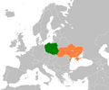
Fayl:Poland Ukraine Locator.png
Qiyofa

Bu prevyuning hajmi: 720 × 600 piksel. Boshqa oʻlchamlari: 288 × 240 piksel | 576 × 480 piksel | 922 × 768 piksel | 1 200 × 1 000 piksel.
Asl fayl (1 200 × 1 000 piksel, fayl hajmi: 65 KB, MIME tipi: image/png)
Fayl tarixi
Faylning biror paytdagi holatini koʻrish uchun tegishli sana/vaqtga bosingiz.
| Sana/Vaqt | Miniatura | Oʻlchamlari | Foydalanuvchi | Izoh | |
|---|---|---|---|---|---|
| joriy | 03:25, 2012-yil 26-fevral |  | 1 200 × 1 000 (65 KB) | OgreBot | (BOT): Reverting to most recent version before archival |
| 03:25, 2012-yil 26-fevral |  | 798 × 485 (98 KB) | OgreBot | (BOT): Uploading old version of file from en.wikipedia; originally uploaded on 2008-12-06 16:20:57 by Dancingwombatsrule | |
| 03:25, 2012-yil 26-fevral |  | 594 × 362 (67 KB) | OgreBot | (BOT): Uploading old version of file from en.wikipedia; originally uploaded on 2008-12-06 16:11:58 by Dancingwombatsrule | |
| 03:25, 2012-yil 26-fevral |  | 800 × 487 (98 KB) | OgreBot | (BOT): Uploading old version of file from en.wikipedia; originally uploaded on 2008-12-06 16:06:05 by Dancingwombatsrule | |
| 03:25, 2012-yil 26-fevral |  | 1 357 × 628 (46 KB) | OgreBot | (BOT): Uploading old version of file from en.wikipedia; originally uploaded on 2007-07-23 15:25:02 by Dancingwombatsrule | |
| 16:40, 2012-yil 24-fevral |  | 1 200 × 1 000 (65 KB) | MGA73bot2 | == {{int:filedesc}} == {{Information |description={{en|1={{en|Map of Europe, highlighting Poland and Ukraine.}}}} |date=6 December 2008 |source=Self made using [[:en::Image:BlankMap-Europe2.png|:Image:BlankMap-Europe2.png... |
Fayllarga ishoratlar
Bu faylga quyidagi sahifa bogʻlangan:
Faylning global foydalanilishi
Ushbu fayl quyidagi vikilarda ishlatilyapti:
- ca.wikipedia.org loyihasida foydalanilishi
- de.wikipedia.org loyihasida foydalanilishi
- el.wikipedia.org loyihasida foydalanilishi
- en.wikipedia.org loyihasida foydalanilishi
- es.wikipedia.org loyihasida foydalanilishi
- eu.wikipedia.org loyihasida foydalanilishi
- fa.wikipedia.org loyihasida foydalanilishi
- fr.wikipedia.org loyihasida foydalanilishi
- he.wikipedia.org loyihasida foydalanilishi
- it.wikipedia.org loyihasida foydalanilishi
- ja.wikipedia.org loyihasida foydalanilishi
- ko.wikipedia.org loyihasida foydalanilishi
- nn.wikipedia.org loyihasida foydalanilishi
- pl.wikipedia.org loyihasida foydalanilishi
- pl.wikiquote.org loyihasida foydalanilishi
- pt.wikipedia.org loyihasida foydalanilishi
- ru.wikinews.org loyihasida foydalanilishi
- tr.wikipedia.org loyihasida foydalanilishi
- uk.wikipedia.org loyihasida foydalanilishi
- Польща
- Гадяцький договір
- Лівицький Андрій Миколайович
- Шумський Олександр Якович
- Слободищенський трактат
- Павличко Дмитро Васильович
- Зборівський договір
- Білоцерківський мирний договір
- Удовенко Геннадій Йосипович
- Старак Теодозій Васильович
- Українці Польщі
- Пилипчук Пилип Каленикович
- Капка Дмитро Леонтійович
- Українсько-польські відносини
- Поляки в Україні
- Польсько-український кордон
- Моцик Олександр Федорович
- Хургін Ісай Якович
- Бесєдовський Григорій Зіновійович
- Харченко Ігор Юрійович
- Сардачук Петро Данилович
- Дещиця Андрій Богданович
- Никоненко Олександр Миколайович
- Мальський Маркіян Зіновійович
Ushbu faylni koʻproq global foydalanishdan koʻring.
