
Fayl:Reliefkarte Jura blank.png

Bu prevyuning hajmi: 790 × 600 piksel. Boshqa oʻlchamlari: 316 × 240 piksel | 633 × 480 piksel | 1 012 × 768 piksel | 1 280 × 972 piksel | 1 988 × 1 509 piksel.
Asl fayl (1 988 × 1 509 piksel, fayl hajmi: 2,76 MB, MIME tipi: image/png)
| Taʼrif |
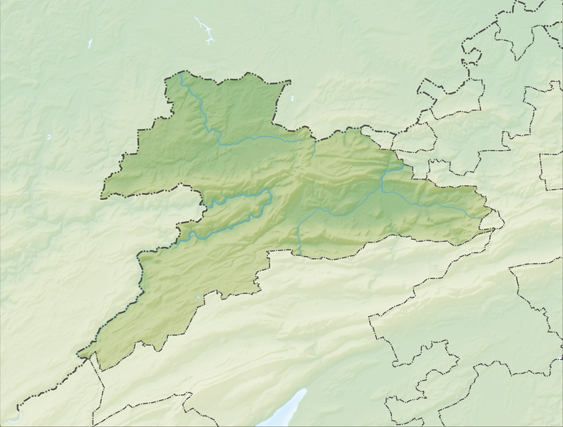
Deutsch: Reliefkarte des Kantons Jura
Topographischer Hintergrund: NASA Shuttle Radar Topography Mission (public domain). SRTM3 v.2. |
||||||||
| Sanasi | |||||||||
| Manba | Oʻzimning ishim | ||||||||
| Muallif | Tschubby | ||||||||
| Ruxsat (Bu faylning takror foydalanilishi) |
I, the copyright holder of this work, hereby publish it under the following licenses:
This file is licensed under the Creative Commons Attribution-Share Alike 2.5 Generic, 2.0 Generic and 1.0 Generic license.
Siz oʻzingiz xohlagan litsenziyani tanlashingiz mumkin. |
||||||||
| Other versions |
 |

Fayl tarixi
Faylning biror paytdagi holatini koʻrish uchun tegishli sana/vaqtga bosingiz.
| Sana/Vaqt | Miniatura | Oʻlchamlari | Foydalanuvchi | Izoh | |
|---|---|---|---|---|---|
| joriy | 06:44, 6-Dekabr 2013 | | 1 988 × 1 509 (2,76 MB) | Tschubby | {{Information |Description= {{de| Reliefkarte des Kantons Jura}} Topographischer Hintergrund: [http://www2.jpl.nasa.gov/srtm NASA Shuttle Radar Topography Mission] (public domain). SRTM3 v.2. |Source={{own}} |Date= 2013-12-06 |Author= [[:de:User:Tschub... |
Fayllarga ishoratlar
Bu faylga quyidagi 2 sahifalar bogʻlangan:
Faylning global foydalanilishi
Ushbu fayl quyidagi vikilarda ishlatilyapti:
- de.wikipedia.org loyihasida foydalanilishi
- Mont Terri
- Scheltenbach
- Col des Rangiers
- Sender Les Ordons
- Delsberger Becken
- Liste von Burgen und Schlössern in der Schweiz
- Étang de la Gruère
- Löwenburg JU
- Wikipedia:Kartenwerkstatt/Positionskarten/Europa
- Vorlage:Positionskarte Schweiz Jura
- Aussichtsturm Faux d’Enson
- Aussichtsturm Mont Renaud
- Panoramaturm Pleigne
- Tabeillon
- Wikipedia:Kartenwerkstatt/Archiv/2017-12
- Benutzer:Tschubby/Reliefkarten
- Col de Montvoie
- Schloss Pruntrut
- Réfus-Turm
- Ruine Roche d’Or
- Étang de Bollement
- Schloss Pleujouse
- Ruine Milandre
- en.wikipedia.org loyihasida foydalanilishi
- Delémont
- Montmelon
- Saint-Ursanne
- Porrentruy
- Courtételle
- Courroux
- Saignelégier
- Boécourt
- Alle, Switzerland
- Bure, Switzerland
- Asuel
- Bassecourt
- Beurnevésin
- Boncourt, Switzerland
- Bonfol
- Bourrignon
- Bressaucourt
- Buix
- Charmoille, Switzerland
- Châtillon, Canton of Jura
- Chevenez
- Coeuve
- Corban, Switzerland
- Cornol
- Courchapoix
- Courchavon
- Courfaivre
Ushbu faylni koʻproq global foydalanishdan koʻring.