
Fayl:Isparta Mimar Sinan (Firdevs Paşa) Cami 2437.jpg

Asl fayl (4 928 × 3 280 piksel, fayl hajmi: 12,47 MB, MIME tipi: image/jpeg)
_Cami_2437.jpg)
Qisqa izoh
| Taʼrif |
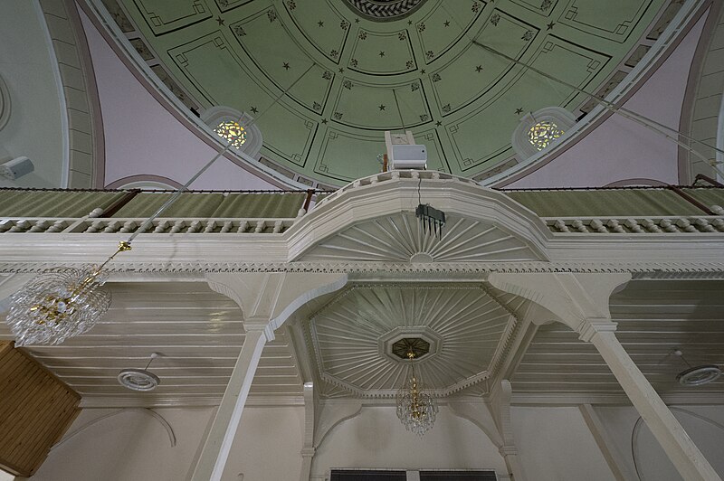
English: Looking up to the balcony above the entrance.
From the local website, put in English: "The mosque has a square plan. It has a single minaret with a single balcony in the northwest direction. The base of the minaret balcony has stalactites and its balusters are decorated with lattice workmanship. There are five small domes in the narthex of the mosque, which has a large dome on the main space. The upper windows of the mosque are decorated with coloured glass workmanship. While all of the upper windows in the south direction have stained glass, it is possible to see this work on the edges of the windows in other directions. The mihrab basement is decorated with seven rows of stalactites. It is known that Mimar Sinan, the Murat Periods, prepared the plans of many mosques in the Ottoman Empire. Several works (Tezkiretü'l Bünyan, Tezkiretü'-l Ebniye and Tufetü'l- Mimarin) state that the Firdevs Pasha Mosque was planned and built in 1561 by Mimar Sinan, who served as the chief architect during the reigns of Suleiman the Magnificent, Selim II Selim and Murat III. In addition, Evliya Çelebi's Travelogue contains the statement "Koca Sinan built this mosque". The mosque, which does not have an inscription, is mentioned in the endowment of Isparta’s Governor Firdevs Bey in 1565 AD and it is understood that Firdevs Bey financed the mosque. It is possible to suggest that the mosque was planned and built by Mimar Sinan, considering both the information in his foundation and the fact that the mosque was built in 1561. |
| Sanasi | |
| Manba | Oʻzimning ishim |
| Muallif | Dosseman |
| Camera location | | View this and other nearby images on: OpenStreetMap |
|---|
_Cami_2437.jpg¶ms=037.764688_N_0030.554602_E_globe:Earth_type:camera__&language=uz)
Litsenziyalash
- Siz erkinsiz:
- ulashishga – ishlanmani nusxalash, tarqatish va uzatish
- remiks qilishga – ishni moslashtirishga
- Quyidagi shartlar asosida:
- atribut – Siz tegishli litsenziyaga havolani taqdim etishingiz va oʻzgartirishlar kiritilganligini koʻrsatishingiz kerak. Siz buni har qanday oqilona yoʻl bilan qilishingiz mumkin, lekin litsenziar Sizni yoki Sizning foydalanishingizni ma'qullashini taklif qiladigan tarzda emas.
- bir xil ulashish – Agar Siz materialni remiks qilsangiz, oʻzgartirsangiz yoki unga asoslansangiz, oʻz hissalaringizni asl nusxadagi kabi bir xil yoki mos litsenziya ostida tarqatishingiz kerak.
Fayl tarixi
Faylning biror paytdagi holatini koʻrish uchun tegishli sana/vaqtga bosingiz.
| Sana/Vaqt | Miniatura | Oʻlchamlari | Foydalanuvchi | Izoh | |
|---|---|---|---|---|---|
| joriy | 11:47, 14-Mart 2023 | | 4 928 × 3 280 (12,47 MB) | Dosseman | Full size |
| 19:27, 4-Oktyabr 2020 |  | 1 600 × 1 065 (277 KB) | Dosseman | Uploaded own work with UploadWizard |
Fayllarga ishoratlar
Bu faylga quyidagi sahifa bogʻlangan:
Faylning global foydalanilishi
Ushbu fayl quyidagi vikilarda ishlatilyapti:
- en.wikipedia.org loyihasida foydalanilishi
- nl.wikipedia.org loyihasida foydalanilishi
_Cami_2437.jpg)