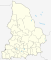
Fayl:Sverdlovskaya-pozkarta.png
Qiyofa

Bu prevyuning hajmi: 514 × 599 piksel. Boshqa oʻlchamlari: 206 × 240 piksel | 412 × 480 piksel | 659 × 768 piksel | 878 × 1 024 piksel | 1 757 × 2 048 piksel | 3 675 × 4 284 piksel.
Asl fayl (3 675 × 4 284 piksel, fayl hajmi: 224 KB, MIME tipi: image/png)
Fayl tarixi
Faylning biror paytdagi holatini koʻrish uchun tegishli sana/vaqtga bosingiz.
| Sana/Vaqt | Miniatura | Oʻlchamlari | Foydalanuvchi | Izoh | |
|---|---|---|---|---|---|
| joriy | 12:05, 2019-yil 17-sentyabr |  | 3 675 × 4 284 (224 KB) | Вальдимар | + селище Тайожний |
| 09:51, 2019-yil 17-sentyabr |  | 3 675 × 4 284 (223 KB) | Вальдимар | підправив кордон Махньовського МО | |
| 09:00, 2019-yil 6-sentyabr |  | 3 675 × 4 284 (223 KB) | Вальдимар | Оновлено кордони міських округів | |
| 08:50, 2012-yil 29-noyabr |  | 3 675 × 4 284 (224 KB) | Botinko | Границы городских округов, утвержденные в 2005-2007 годах | |
| 16:26, 2010-yil 22-mart |  | 2 237 × 2 608 (71 KB) | Const st | убрал рамку | |
| 16:15, 2010-yil 22-mart |  | 2 237 × 2 608 (56 KB) | Const st | цвета и линии привёл в соответствие с принятыми нормами | |
| 08:27, 2007-yil 25-may |  | 2 237 × 2 608 (74 KB) | Koryakov Yuri | {{Information |Description= |Source=self-made |Date=May 2007 |Author= Koryakov Yuri |other_versions= }} |
Fayllarga ishoratlar
Bu faylga quyidagi 4 sahifalar bogʻlangan:
Faylning global foydalanilishi
Ushbu fayl quyidagi vikilarda ishlatilyapti:
- af.wikipedia.org loyihasida foydalanilishi
- alt.wikipedia.org loyihasida foydalanilishi
- ar.wikipedia.org loyihasida foydalanilishi
- arz.wikipedia.org loyihasida foydalanilishi
- azb.wikipedia.org loyihasida foydalanilishi
- az.wikipedia.org loyihasida foydalanilishi
- ba.wikipedia.org loyihasida foydalanilishi
- Ҡалып:ПозКарта Рәсәй Свердловск өлкәһе
- Екатеринбург
- Араҡай (Свердловск өлкәһе)
- Әжеғол
- Әртә-Шиғыр
- Волчанск (Свердловск өлкәһе)
- Шәкүр (Свердловск өлкәһе)
- Аҡҡул (Свердловск өлкәһе)
- Өфө-Шигер
- Ғәйнә (Свердловск өлкәһе)
- Биш ауыл
- Рахманғол
- Үрмәкәй (Свердловск өлкәһе)
- Аҡбаш (Свердловск өлкәһе)
- Ҡуян (Свердловск өлкәһе)
- Бәйәктамаҡ
- Бикән
- Бәхмәт
- Яманйылға (Свердловск өлкәһе)
- Түбәнге Тагил
- Әртә
- Боғалыштамаҡ
- Табанлыкүл
- Һыҙғы (ауыл)
- Үрге Бәйәк
- Белембай (Свердловск өлкәһе)
- Ирбит (ҡала)
- Октябрьский (Свердловск өлкәһе)
- Мурзинка (Горноуральск ҡала округы)
- be.wikipedia.org loyihasida foydalanilishi
Ushbu faylni koʻproq global foydalanishdan koʻring.
