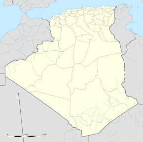
Ouled Aouf
Qiyofa
Ouled Aouf أولاد عوف | |
|---|---|
| 35°27′20″N 5°45′25″E / 35.45556°N 5.75694°E | |
| Mamlakat | Jazoir |
| Provinsiya | Batna |
| Tuman | [[Aïn Touta[1]]] |
| Maydon | 149 km2 (58 kv mi) |
| Aholisi (2008[2]) |
1 724 |
| Vaqt mintaqasi | UTC+1 |
|
| |
Ouled Aouf — Jazoir davlatining shimoli-sharqiy hududidagi shaharcha.
Kommuna joylashgan joylar
[tahrir | manbasini tahrirlash]Ain Touta kommunasi quyidagi 25 ta aholi punktlaridan iboratdir[3]:
- Baasou
- Berriche
- Bitamat I
- Bitamat II
- Bouizourane
- Chihat
- Idahriene
- Ikichouine
- Kenzria I
- Kenzria II
- Lakraim
- Mehadjib
- Rhamna
- Rouagued
- Ouled Afercha
- Ouled Aouf
- Ouled Ben Amouna
- Seradha
- Stahi
- Tamezrit
- Tamssaghit N' Megaach
- Tahimayet
- Aith-Soumères
- Aith el Berkanes
- Chiheth
- Thaghith N'woudhayens
- Timesla
- Igra n'Amor
- Borenda
- Icharens
Manbalar
[tahrir | manbasini tahrirlash]- ↑ „Décret executif n° 91-306 du 24 août 1991 fixant la liste des communes animées par chaque chef de daïra. 05 - Wilaya de Batna“ [List of municipalities animated by each District chief: 05 - Batna Province] (fr) 1295. Journal officiel de la République Algérienne (1991-yil 4-sentyabr). Qaraldi: 2019-yil 9-noyabr.
- ↑ „Wilaya de Batna: répartition de la population résidente des ménages ordinaires et collectifs, selon la commune de résidence et la dispersion“ (FR). Qaraldi: 2019-yil 9-noyabr.. Data from the 2008 General Population and Housing Census on the site of the NOS Algeria.
- ↑ "Décret n° 84-365, fixant la composition, la consistance et les limites territoriale des communes. Wilaya de Batna". Journal officiel de la République Algérienne (67): 1481. 19 December 1984. http://www.joradp.dz/JO8499/1984/067/FP1481.pdf. Qaraldi: 3 October 2019.Ouled Aouf]]

